
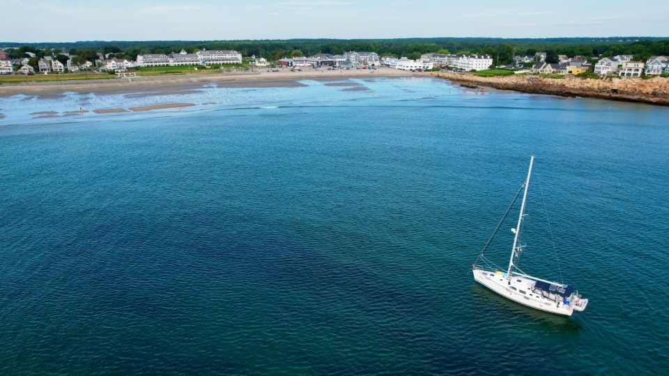
The Grenadines are a chain of small islands strung between St Vincent and Grenada along the eastern edge of the Caribbean, and they are the closest thing sailing has to a walking trail. Each anchorage is a day’s easy sail from the last, the trade wind blows from the same quarter almost every day, and the water between the islands is deep and clean. We have sailed the chain more than once and still find ourselves planning the same route: south from Bequia, east to Mustique, then down through Canouan and Mayreau to the reef at the Tobago Cays.
Bequia, where the chain begins
Bequia lies about 9 nautical miles south of the main island of St Vincent across the Bequia Channel, and Admiralty Bay on its west coast is the natural first anchorage. The bay is wide, well sheltered from the trade wind and deep enough that most boats anchor in 5 to 10 metres of water off the town of Port Elizabeth. The island is roughly seven square miles, with a waterfront path that runs from the ferry dock around the bay past small boatyards where wooden boats are still built by hand.
Bequia has a long whaling tradition, one of the few places in the world where a small aboriginal quota still exists, and a model-boat craft that grew out of it. For the sailor it is the last serious provisioning stop before the outer islands. There is a fresh produce market near the dock, bakeries, fuel and water alongside, and a customs office. Everything south of here is smaller, so we fill the lockers in Bequia and plan to top up rather than stock up afterwards.
Mustique and the beat to windward
Mustique sits about 14 nautical miles southeast of Bequia, and that direction matters. The trade wind in season blows from the east to northeast at 15 to 20 knots, so Bequia to Mustique is a beat, close-hauled with a short sea on the bow. Most boats leave early, tack their way across in three to four hours and arrive with salt on everything. The reward is Britannia Bay, a small anchorage on the west side where the island keeps a line of mooring buoys and the water is a clear pale green over sand.
Mustique is a private island of about 1,400 acres, and visiting yachts are welcome for a limited stay against a mooring fee. There is a small village, a bakery, and a hillside of red-roofed houses, but the island’s real gift is the swimming off Macaroni Beach on the windward side, where Atlantic rollers break on white sand. We go for one night and rarely stay longer.
Canouan and the reach to Mayreau
From Mustique the route turns southwest, which puts the trade wind on the beam. Canouan is about 12 nautical miles away, and the sail is one of the finest in the chain: a fast, flat reach past the low island of Petit Mustique with the boat heeled and steady. Charlestown Bay on Canouan’s west coast is a good stop for lunch or a night, sheltered by a reef and with a sandy bottom in 4 to 8 metres.
Mayreau is another 8 nautical miles south. It is the smallest inhabited island in the Grenadines, with a single village of perhaps 300 people on the hill and no proper road until relatively recently. Saltwhistle Bay on the north end is a near-perfect crescent of sand with room for a dozen boats, though the swell can wrap around the point in the winter months. Saline Bay on the west side is bigger, more open, and closer to the village path that climbs to a small stone church with a view over the whole southern chain.
The Tobago Cays and the turtle sanctuary
The Tobago Cays lie just 3 nautical miles east of Mayreau, and the approach is the moment every sailor remembers. Five small uninhabited islands, Petit Rameau, Petit Bateau, Baradal, Jamesby and Petit Tabac, sit behind Horseshoe Reef, a curve of coral more than two miles long that takes the full weight of the Atlantic and leaves the water inside it flat. Boats anchor or pick up a mooring in the channel between the cays in 3 to 6 metres of water so clear that the anchor chain can be seen lying on the sand.
The cays are a marine park with a daily fee per person, collected by rangers who come around by boat. Anchoring is restricted to sand, and the area off Baradal is a turtle sanctuary where green turtles graze on seagrass in water barely a metre deep. Snorkelling with them requires nothing more than a mask and patience. On the outside of Horseshoe Reef the coral drops away and the fish are bigger; on the inside there is nothing to do but float. Local boats sell bread, ice and, in season, lobster grilled on the beach.
Season, wind and the honest distances
The Grenadines lie at about 12 to 13 degrees north, which places them at the southern edge of the hurricane belt. The dry season and the sailing season are the same thing: December to May, when the trade wind is steady from the east-northeast at 15 to 20 knots and rain comes as brief passing showers. The Christmas winds of late December and January can blow 25 knots for days at a time. Hurricane season runs from June to November, with the highest risk from August to October.
- St Vincent to Bequia: about 9 nautical miles, usually a reach.
- Bequia to Mustique: about 14 nautical miles, a beat to windward.
- Mustique to Canouan: about 12 nautical miles, a beam reach.
- Canouan to Mayreau: about 8 nautical miles.
- Mayreau to the Tobago Cays: about 3 nautical miles.
- Tobago Cays to Union Island: about 5 nautical miles, the customs port for clearing out.
Provisioning and the rhythm of the chain
The islands get smaller and simpler as we go south, and the boat’s stores should reflect that. Bequia has real shops; Mustique has a bakery and a small grocery; Canouan and Mayreau have a few village stores; the Tobago Cays have only what the vendors bring by boat. Union Island, at the bottom of the chain, has a market and a customs post for boats continuing to Grenada. We plan meals for the whole week in Bequia and carry twice the water we think we need.
The total run from Bequia to the Tobago Cays is roughly 40 nautical miles by the island-hopping route, and it deserves a week. Sailed in a rush it is a series of passages; sailed slowly it becomes a study in how a chain of islands changes character mile by mile, from the working harbour of Port Elizabeth to a sandbar with a name and a turtle.